 |
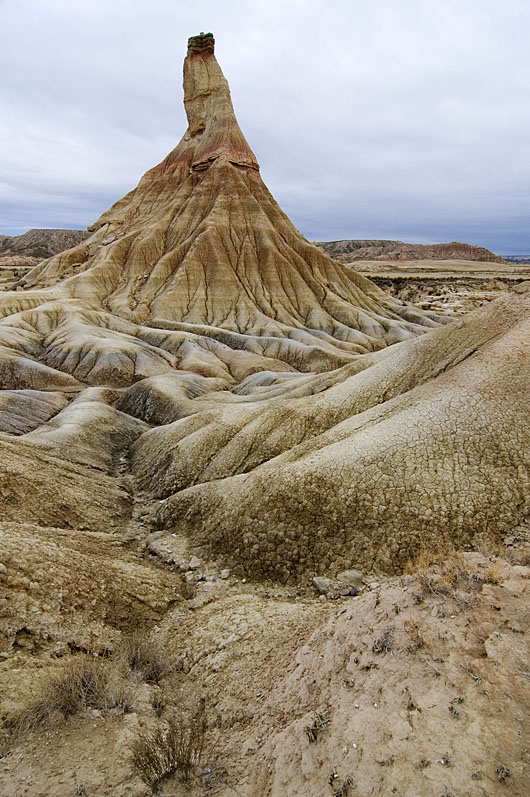
| Castildetierra is one of the many hills sculpted by erosion of the ancient sediment infill of the Ebro Basin at Bardenas Reales (Navarra, Spain). Photo: Larrión & Pimoulier. Location: 42.2103 N, 1.5157 W |
Despite the most recent sedimentary has been removed by erosion, our study could date this major drainage change at 12.0-7.5 million years ago, based on isostatic modeling constrained with paleomagnetic data. In these badlands at Bardenas Reales (Navarra), high erosion rates have been measured in the order of millimeters per year, but how these rates link to the long-term history of the region is unclear. Other places in the basin show Pleistocene erosion rates in the order of 0.1-0.4 mm/yr, whereas our results suggest an average erosion rate since the Miocene of 0.05-0.1 mm/yr.
Summary of the scientific article in Geology: Basins formed within mountainous regions often become perfect sedimentary traps that do not drain to the sea but to internal evaporitic lakes. When they do, their sediment layers ideally record the climatic, topographic, and tectonic history of the surroundings. And when these basins eventually overtop or overfill with sediment, they are rapidly excavated by the new outflowing fluvial network, exposing excellent stratigraphic outcrops. However, this erosion often removes the uppermost basin infill, and essential information about the late basin history is lost. We have estimated the timing and elevation of the maximum infill of the Ebro basin (NE Spain) by computing the rebound of the basin in response to erosion, adopting the common idea that the Earth's rigid outer shell (the lithosphere) rests on a fluid magmatic asthenosphere in an Archimedes-type equilibrium (isostasy). We combine these calculations with existing paleomagnetic ages of the sediment basin infill. The results show that the basin became overfilled between 12 and 7.5 million years ago, and that it reached a maximum elevation of up to 750 m above present sea level. The basin has been ever since incised at a rate close to 0.1 mm/yr and has been isostatically uplifted by up to 630 m at its center. This uplift may explain why the Ebro River, opposite to other large Mediterranean rivers, does not present a deep gorge excavated within its own basin during the desiccation of the Mediterranean (Messinian salinity crisis, 5.5 million years ago).
Summary of the scientific article in Geology: Basins formed within mountainous regions often become perfect sedimentary traps that do not drain to the sea but to internal evaporitic lakes. When they do, their sediment layers ideally record the climatic, topographic, and tectonic history of the surroundings. And when these basins eventually overtop or overfill with sediment, they are rapidly excavated by the new outflowing fluvial network, exposing excellent stratigraphic outcrops. However, this erosion often removes the uppermost basin infill, and essential information about the late basin history is lost. We have estimated the timing and elevation of the maximum infill of the Ebro basin (NE Spain) by computing the rebound of the basin in response to erosion, adopting the common idea that the Earth's rigid outer shell (the lithosphere) rests on a fluid magmatic asthenosphere in an Archimedes-type equilibrium (isostasy). We combine these calculations with existing paleomagnetic ages of the sediment basin infill. The results show that the basin became overfilled between 12 and 7.5 million years ago, and that it reached a maximum elevation of up to 750 m above present sea level. The basin has been ever since incised at a rate close to 0.1 mm/yr and has been isostatically uplifted by up to 630 m at its center. This uplift may explain why the Ebro River, opposite to other large Mediterranean rivers, does not present a deep gorge excavated within its own basin during the desiccation of the Mediterranean (Messinian salinity crisis, 5.5 million years ago).


